North Island

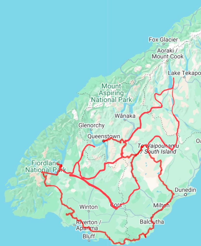
I didn’t fancy spending any time in Wellington and wanted to keep riding whilst the weather was good, so I headed straight out of the city when the ferry disembarked. The cycle path I was riding on felt pretty sketchy, with just a white line separating me from the motorway, but I figured it must be alright as I saw two people casually running down it.

Loading up at the supermarket on the Wellington outskirts, I was informed by a local not to lock my bike up anywhere north of Auckland as it would get stolen. I figured I’d take my chances when I got there, as I didn’t really have any other choice.

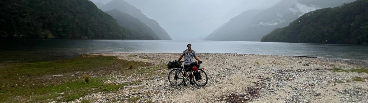
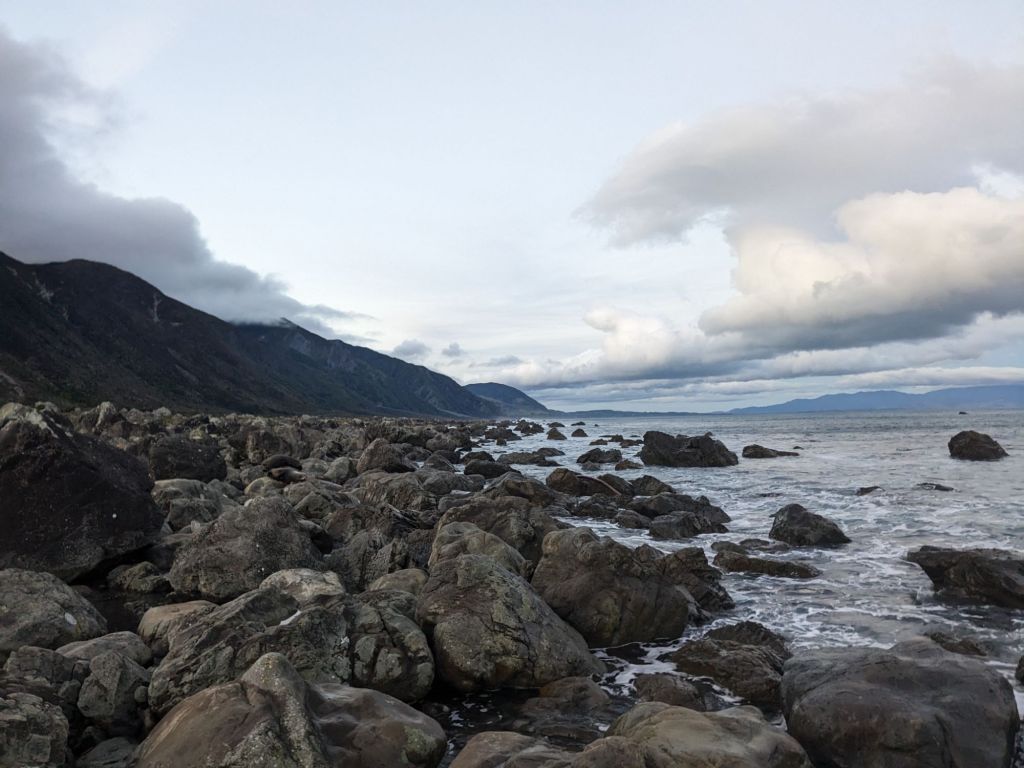
That first night, I camped along the coastal trail which was tough going, as it was a very sandy track and was so windy I ended up just sleeping under a rock, not wanting to try to pitch my tent.


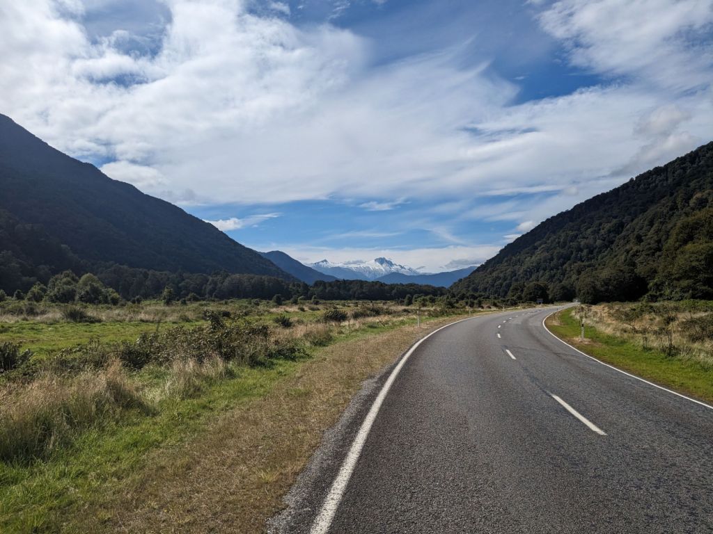
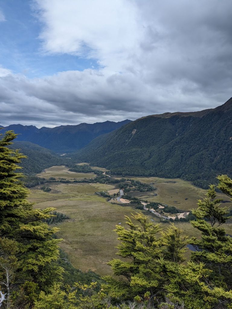
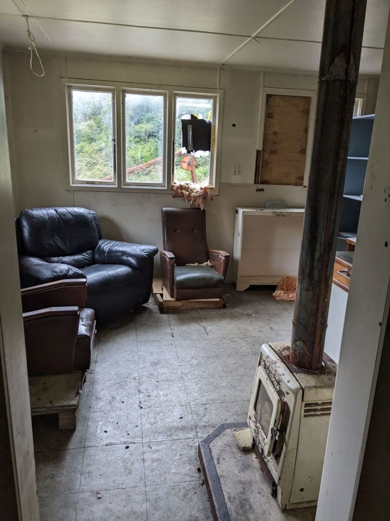
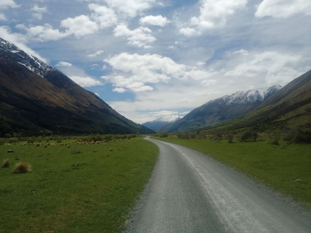
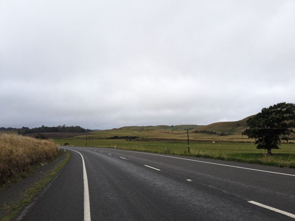
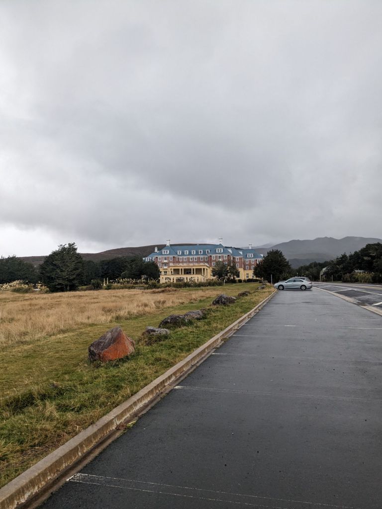
The next few days were spent riding along a highway through just farmland and some bad weather. It was pretty mentally draining as it’s just not that ‘epic’ and hard to take any breaks through the rain. Eventually, I made it to Tongariro National Park and camped at the town of Whakapapa. The town felt very eerie, with a hotel that looked out of The Shining and a huge car park and visitor centre that were both empty. Fortunately, there was at least someone to check me into the campsite and let me stash my bike in his garage whilst I walked the Northern Circuit.


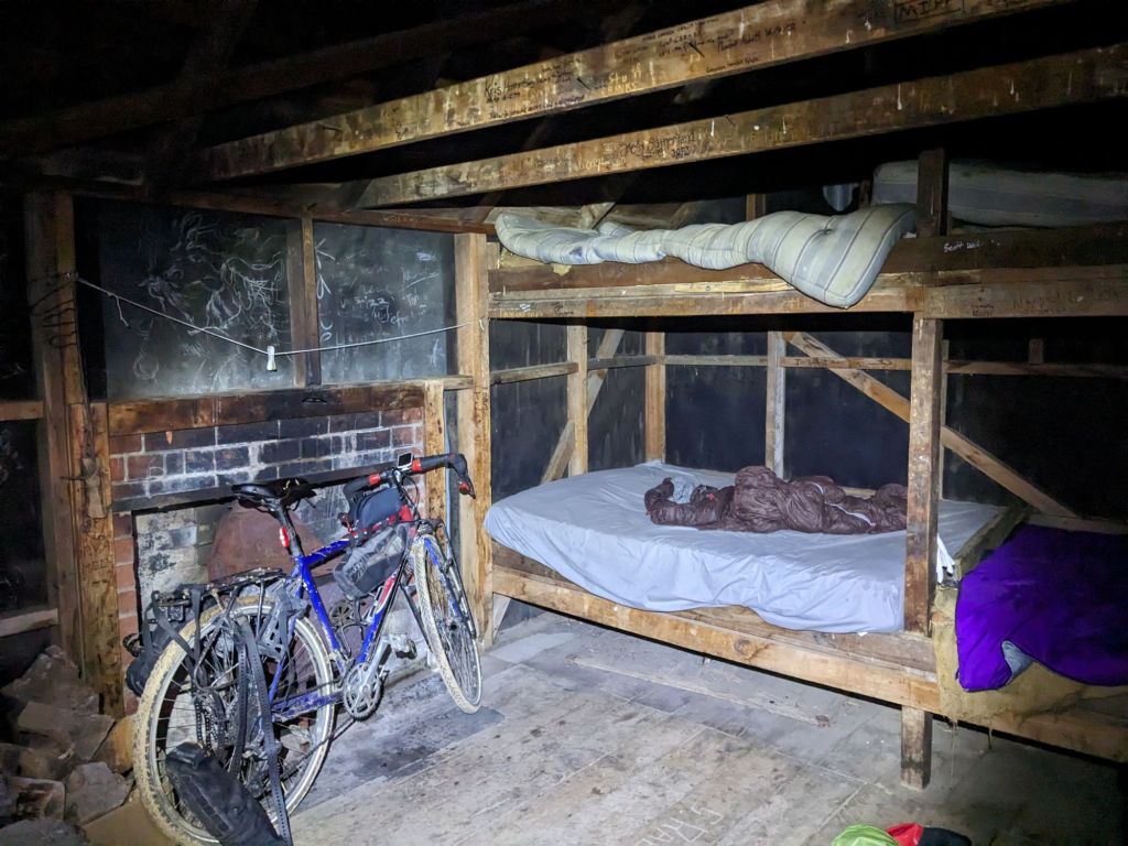
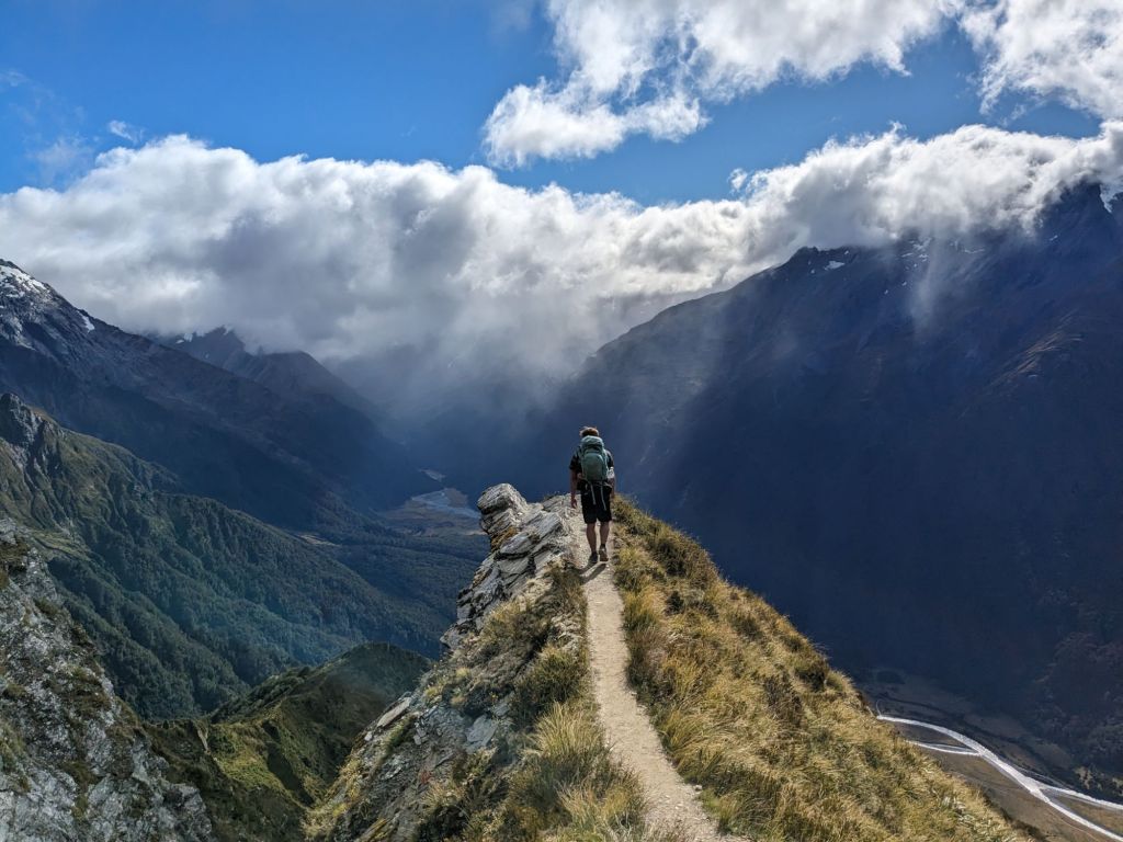
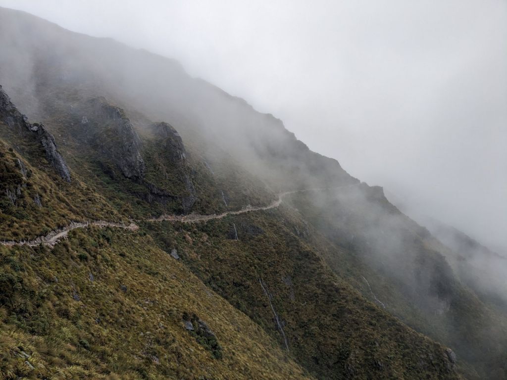
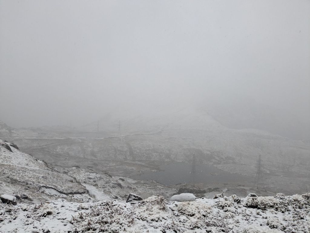
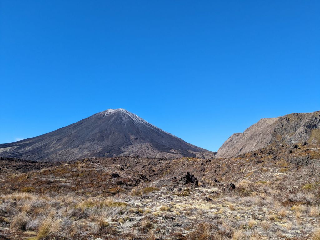
The first day of the walk was amazing, going up a volcano and getting hit by the steam coming out of the vents. Then, crossing over the pass and winding between the Emerald Lakes felt like being on a different planet. I made it to the hut, which was very social as it was the first weekend out of peak season, so the price of a bunk was $100 less than a few days before and lots of locals were taking advantage.


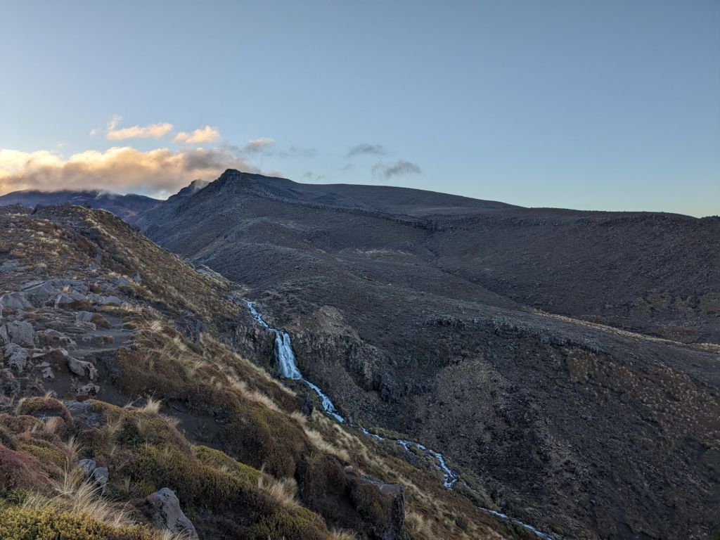
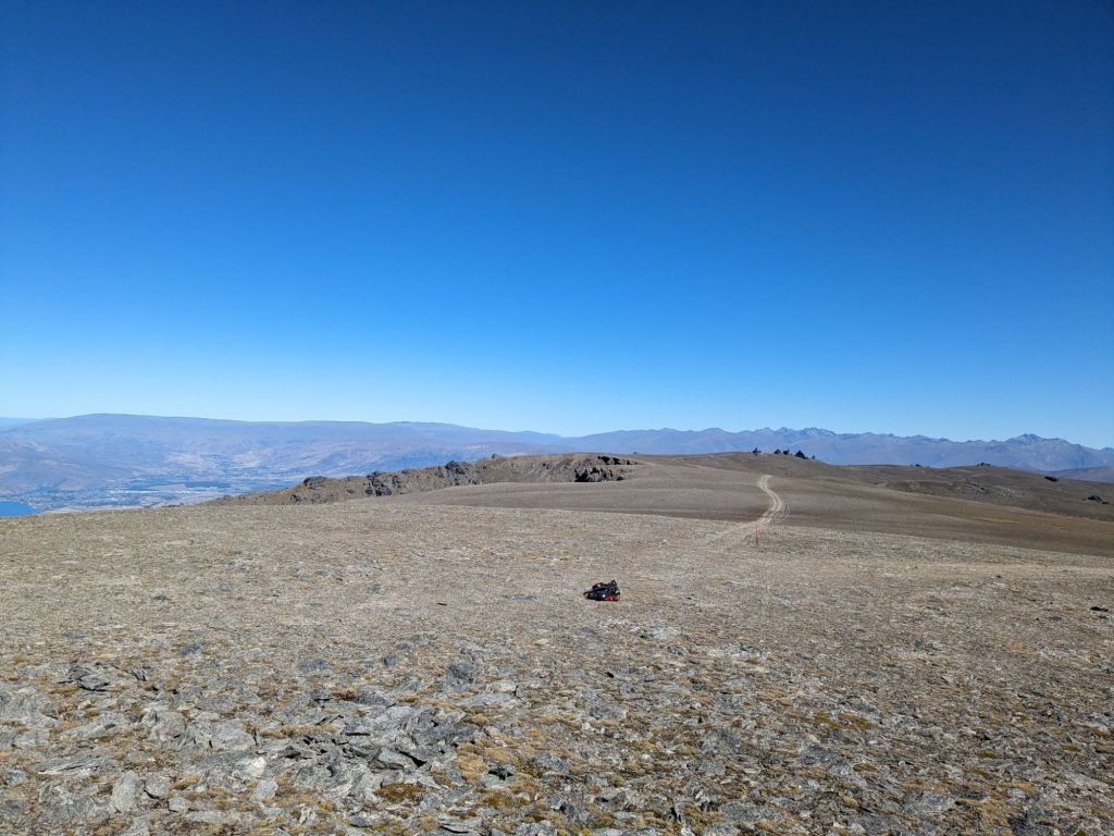
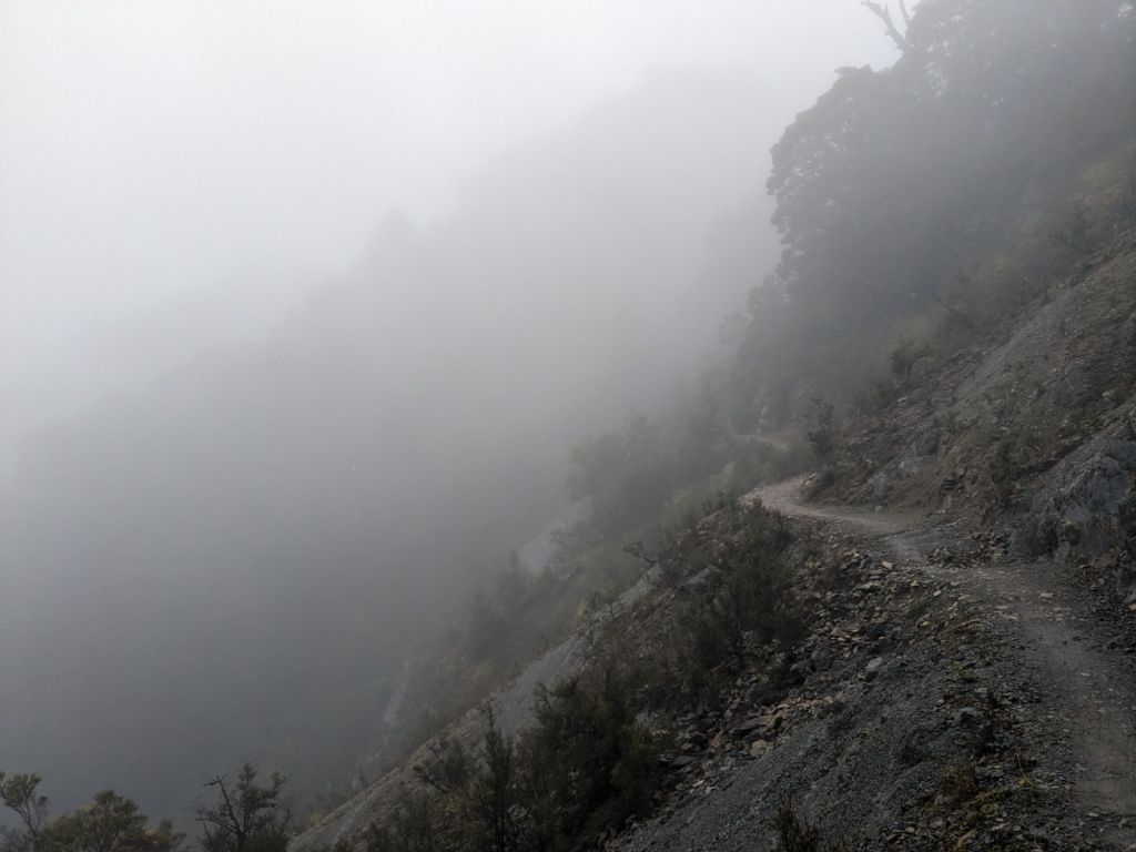
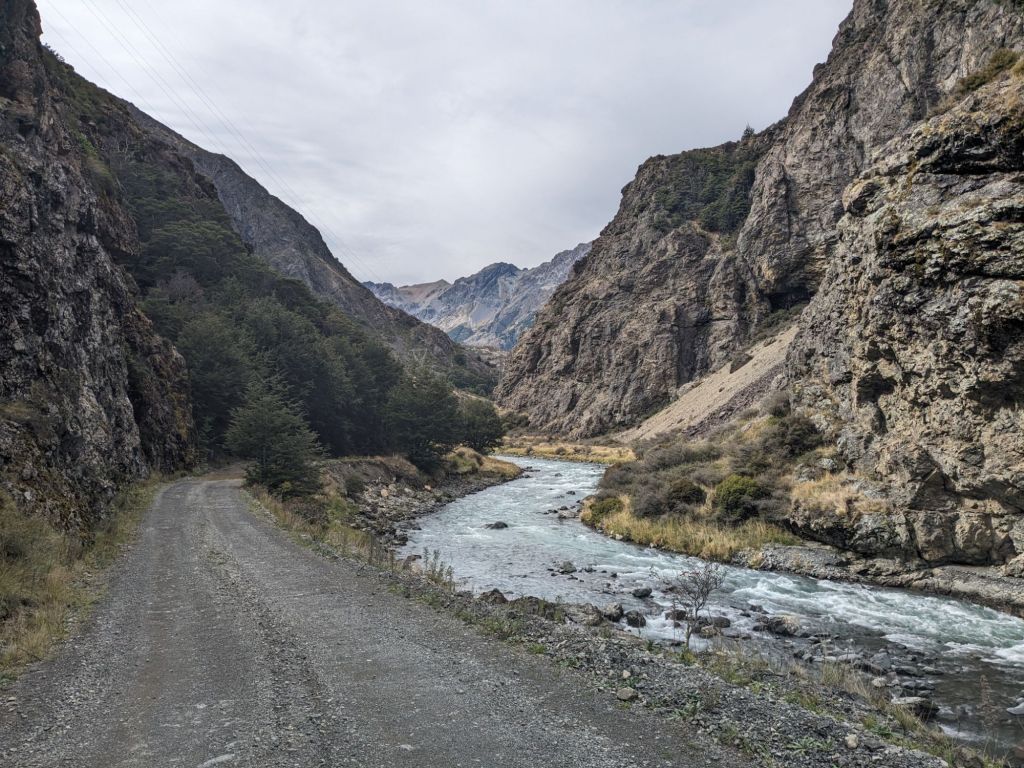
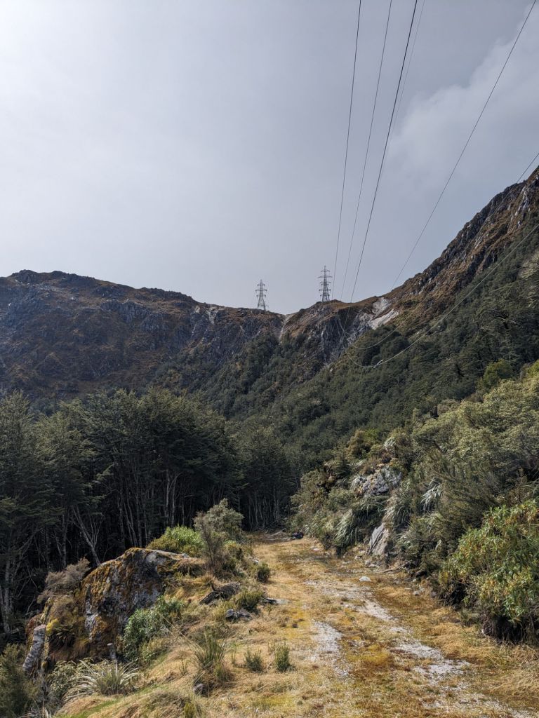
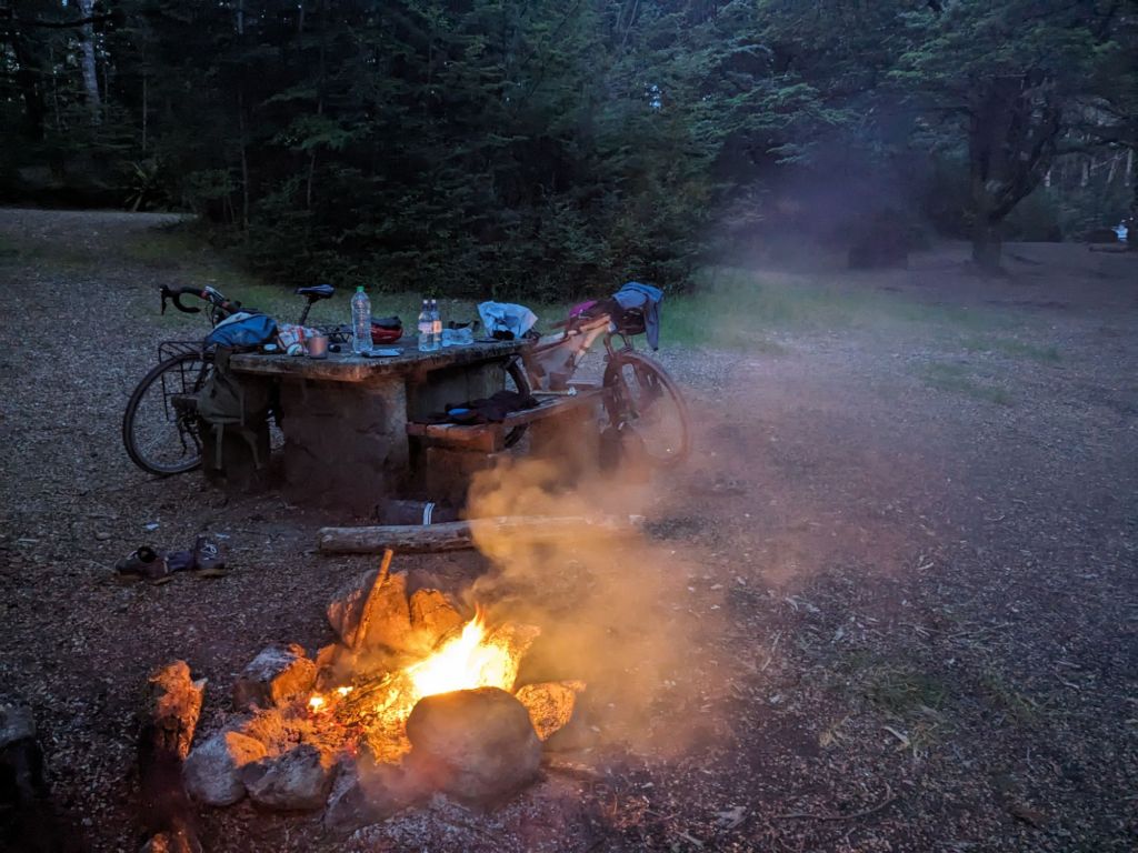
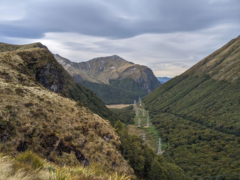
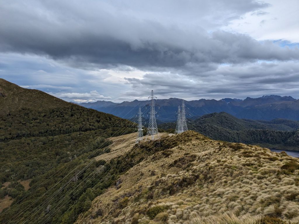
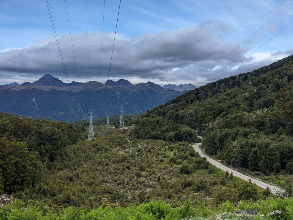
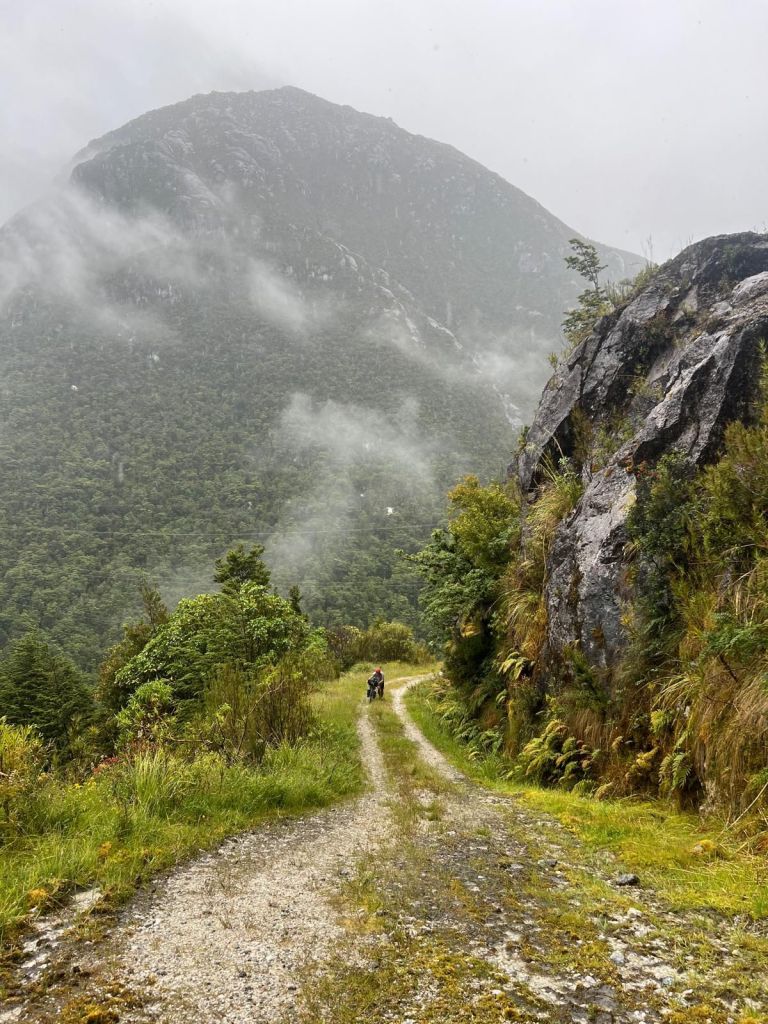
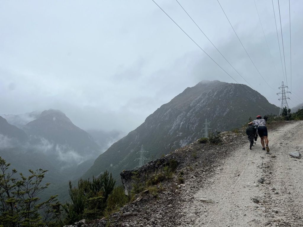
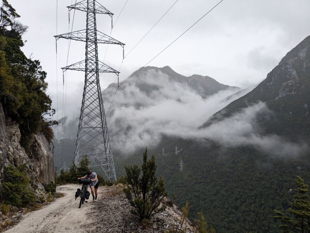
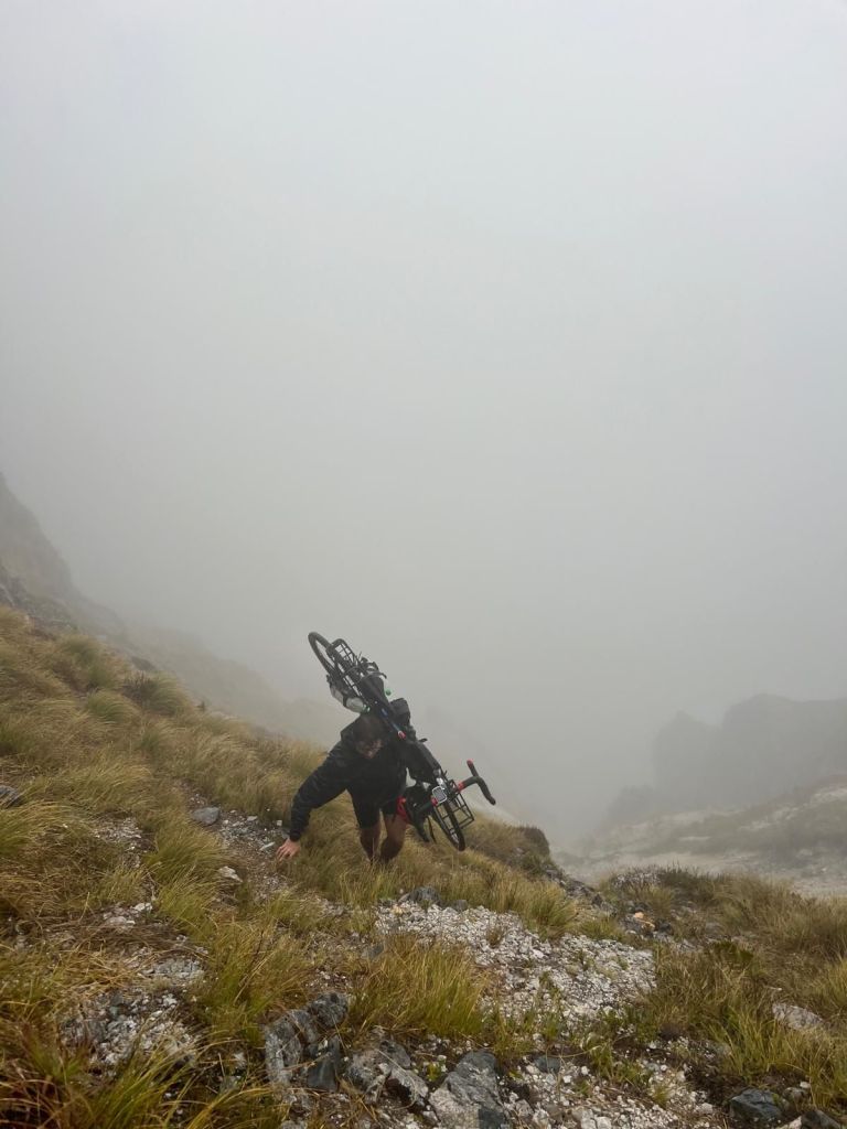
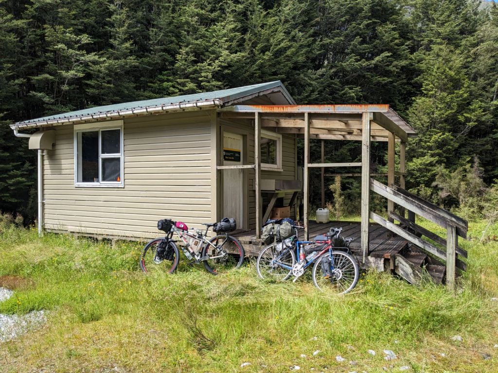
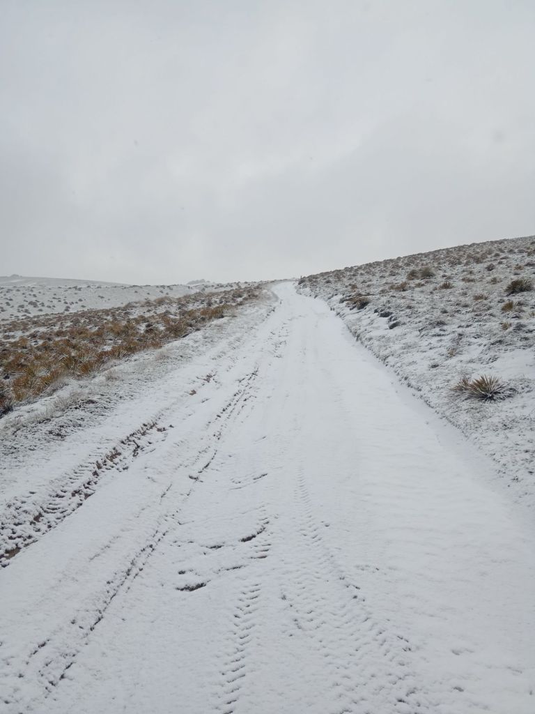
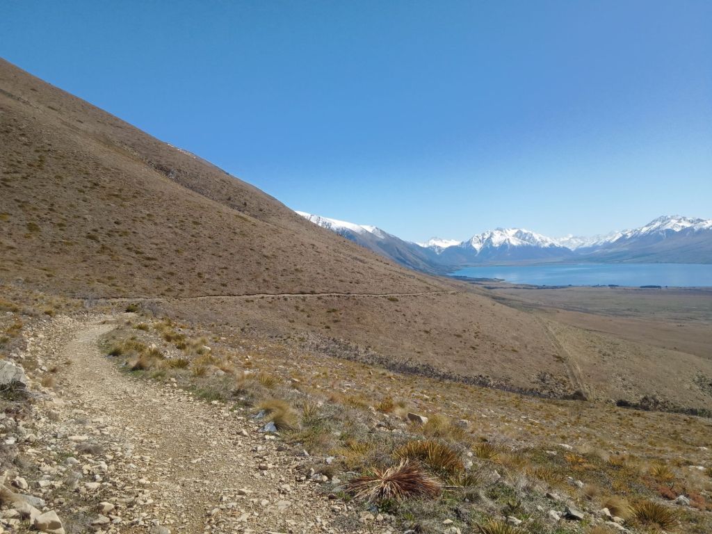
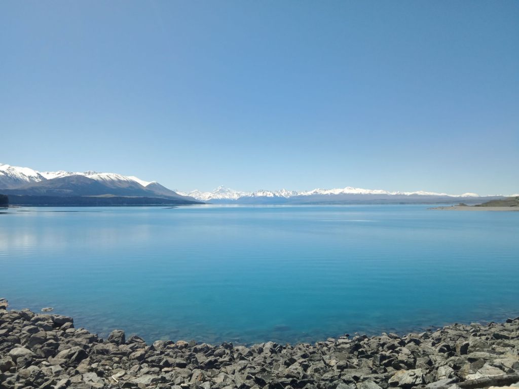
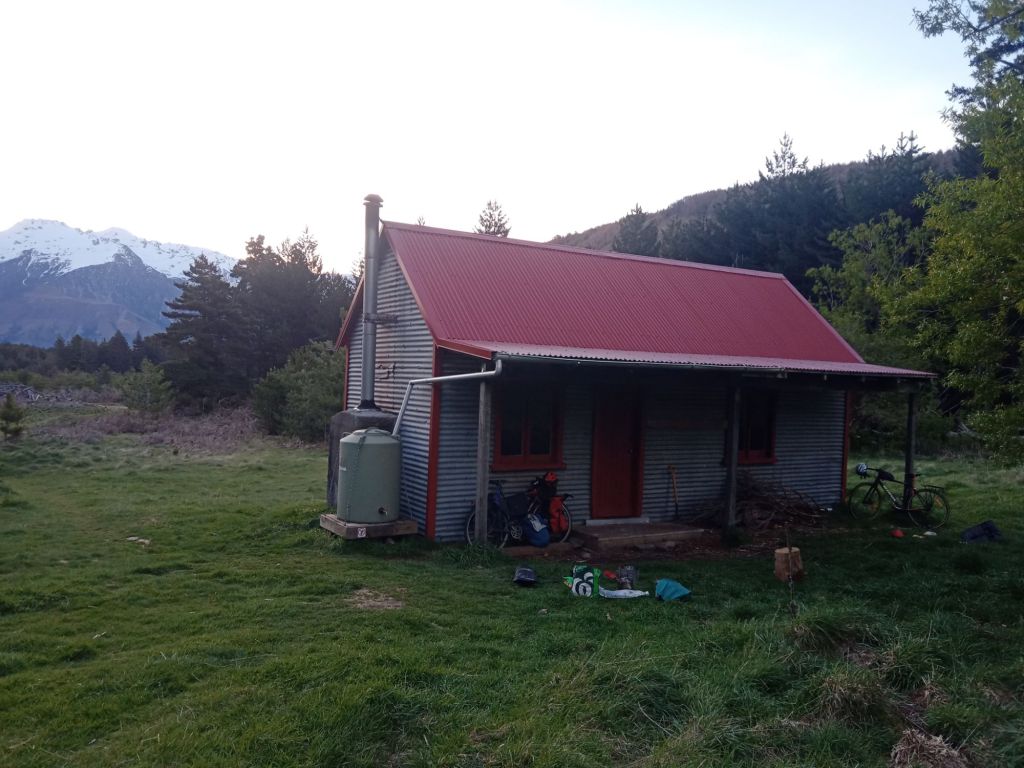
The rest of the walk was alright, walking back to Whakapapa the other side of Mount Ngauruhoe with less good views. I continued on the bike north along the 42 Traverse, a 4×4 track crossing State Forest 42. This was great except for one hill with so much mud. This was a small side track constructed to detour around a landslide and was impossible to ride or even walk up. Every time I’d take a step forward, I’d slide back the same distance and was just stationary, stuck in the wet, slippy mud for about five minutes. Eventually, by grabbing some overhanging tree branches and no longer caring about trying to stay clean, I made it up the hill. I kept pushing on into the dark to make it to the hut at the start of the Timber Trail to get some shelter from the freezing temperatures coming in that evening.


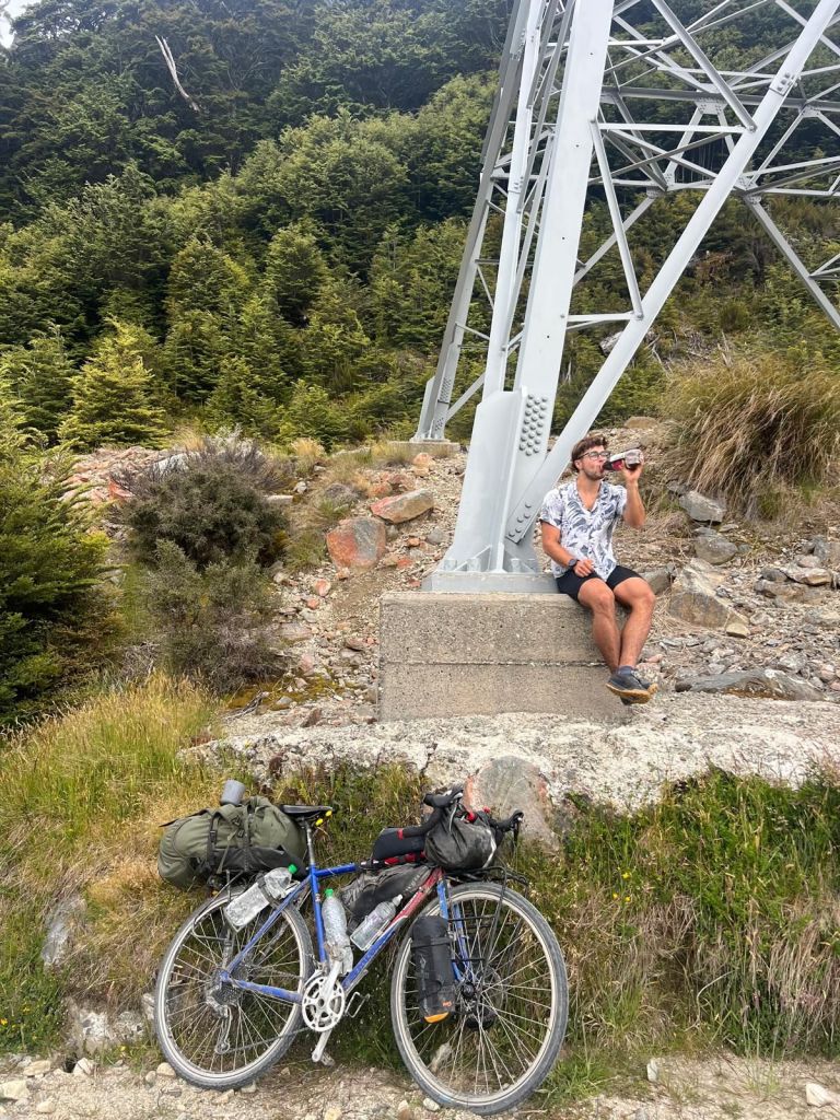
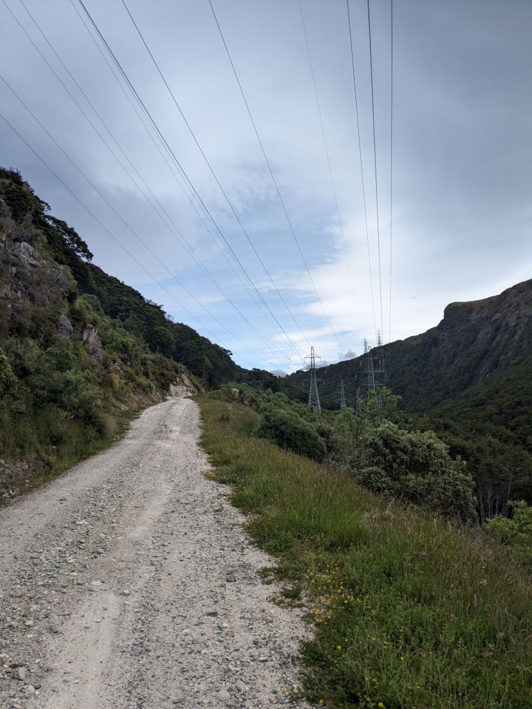
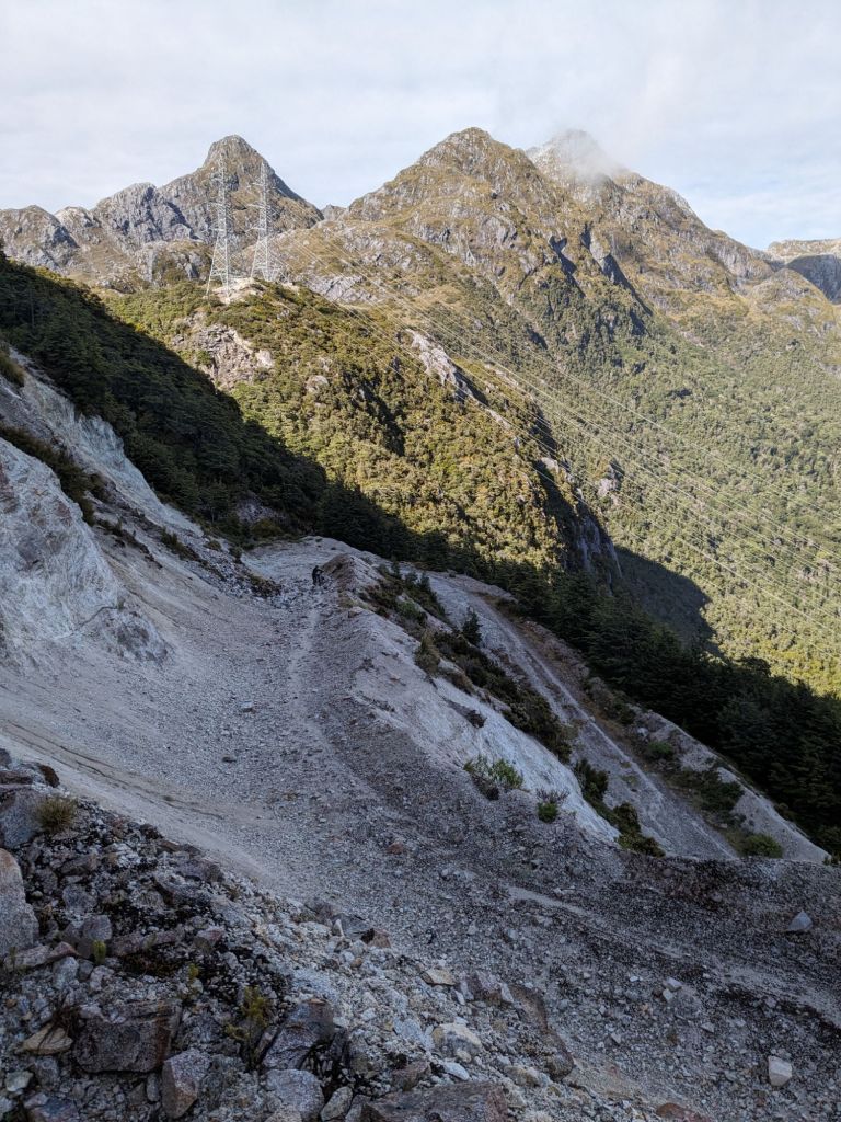
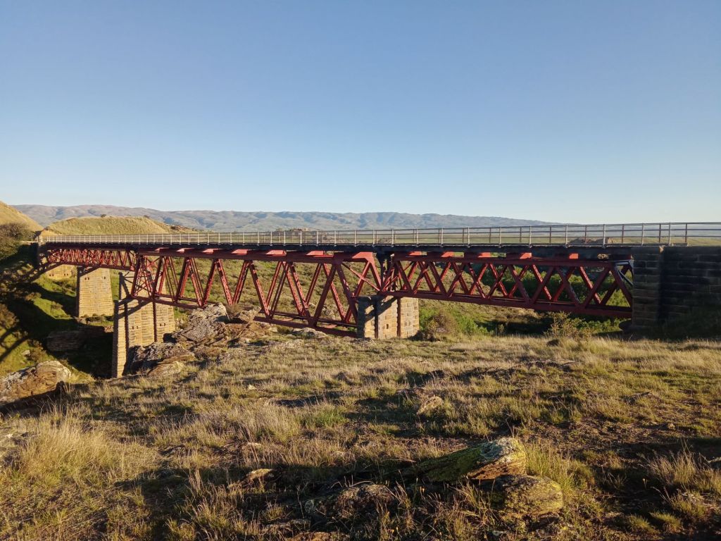
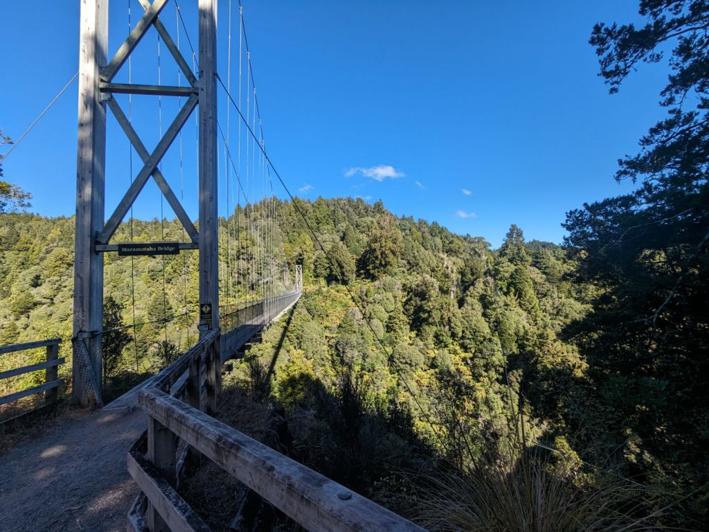
The Timber Trail was a really good track: well-graded, smooth surface with some impressive swing bridges across the valleys.


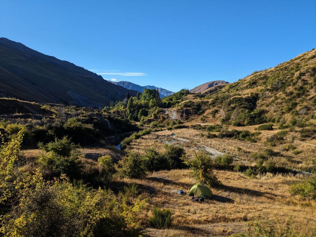
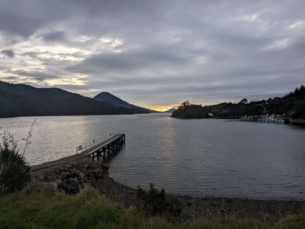
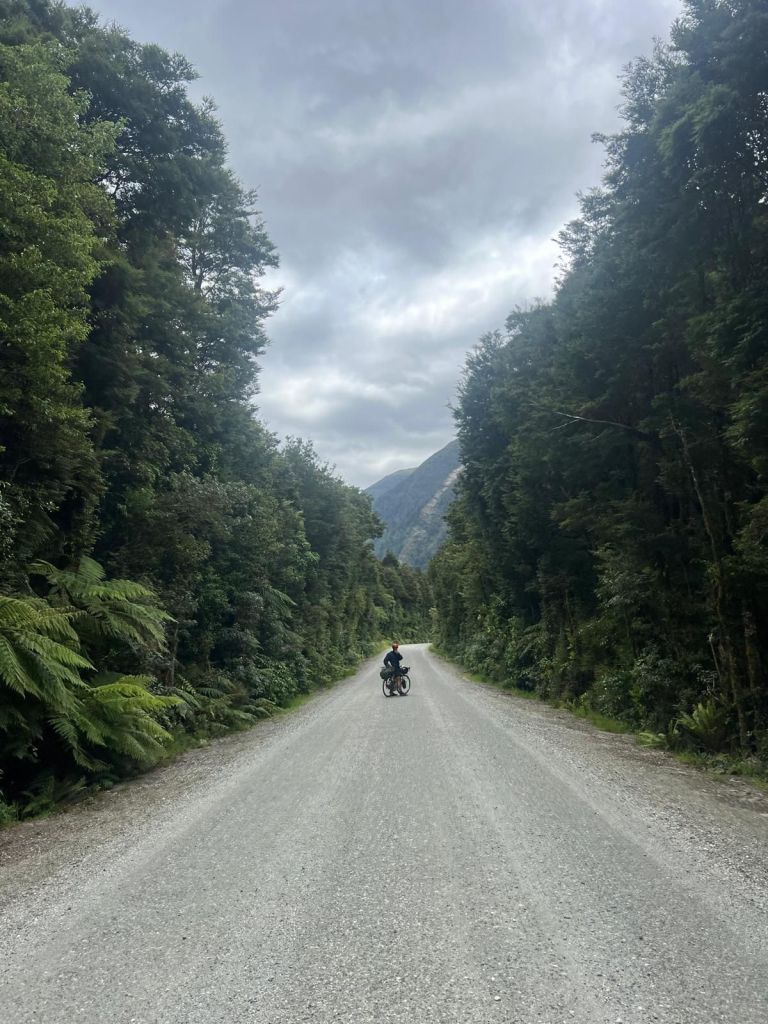
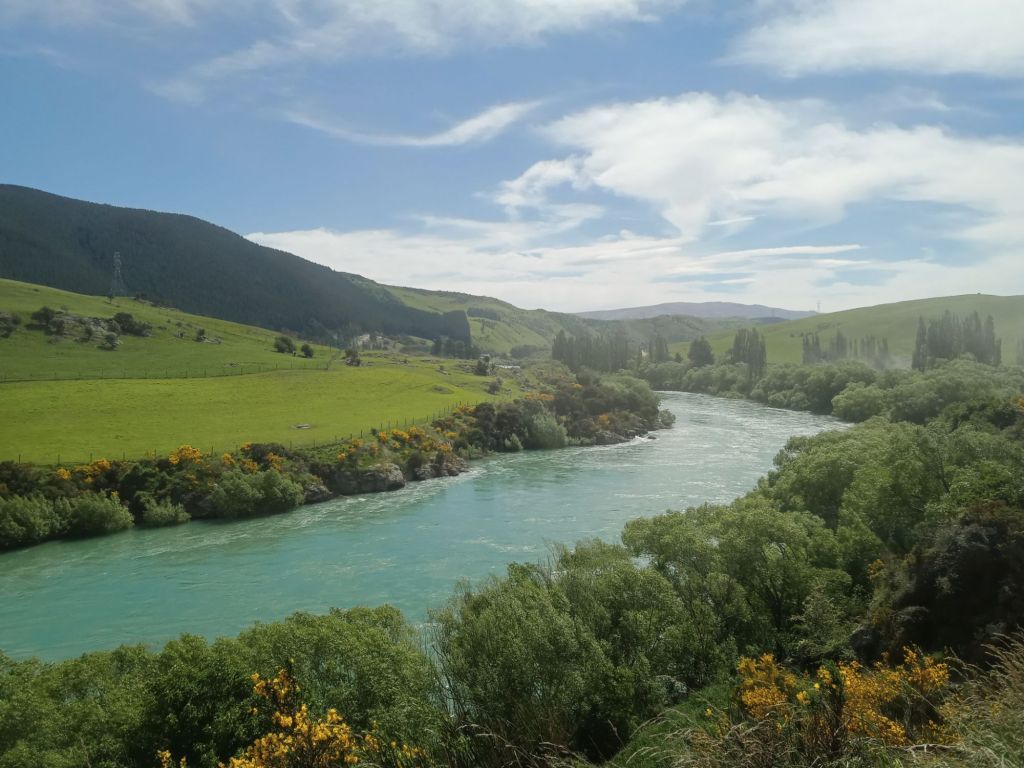
Continuing north, the weather was definitely improving but the riding was now mostly just through farmland on the occasional rail trail. I crossed Auckland, not stopping, knowing I’d be back to get my flight out, and then had a few more days through the rolling hills towards Cape Reinga.


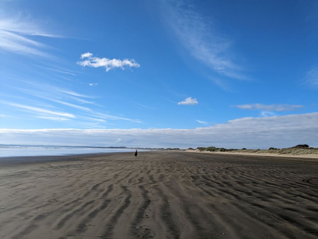
The final stretch of my journey would take me up Ninety Mile Beach. This 85 km-long beach is classified as a road, but is only really passable at low tide when the sand is hard. Reuniting with Elise at the start of the beach, we set off at about 4 pm, riding out into the setting sun. Knowing tide windows were best that night, then again only until about 8 am the following morning, we tried to cover as much ground as possible that night, riding through the sunset then continuing into the darkness. This was an amazing experience and the photos definitely do it justice, riding through some incredibly coloured skies and with the reflection on the wet sand. There was just enough starlight to see where we were going through the dark and it was so cool riding into the darkness not knowing what was around.


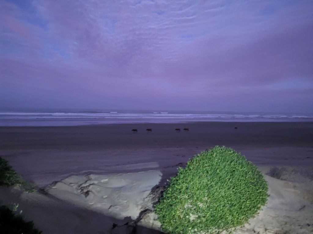
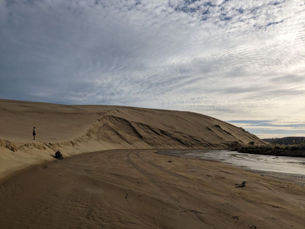
Camping out on the dunes offered a great sunrise in the morning, with a slight scare from a pack of horses who looked quite spooky in the dim morning light. All that now remained of the route to the top of NZ was rejoining the tarmac via a tough riverbed track and a few hills before Cape Reinga.


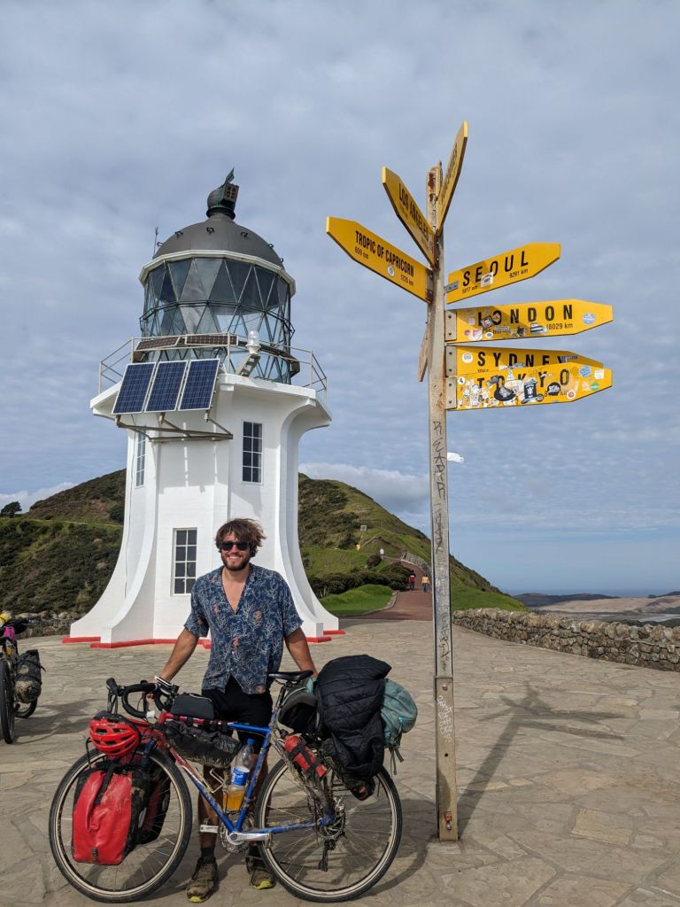
The feeling at the top was mostly relief. The bike had really started to play up over the last few days and I’d already ordered myself a new bike to arrive in Perth, so I didn’t want to spend any extra money keeping this one going. The gears were barely working and now the left crank would loosen and come off about every day. It made the feeling of riding through the salt water more enjoyable, knowing it didn’t matter about the corrosion. After a few obligatory pictures at the lighthouse, we rode back to the beach to camp for the night.


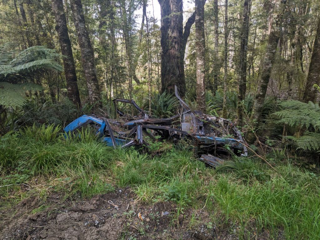
I had a few days until my flight out of Auckland so decided to ride another route south before taking a bus. Unfortunately, the bike’s crank snapped off. This left me scooting it down a small country road, trying to hitch a lift with any passing vehicle. Eventually I got picked up and taken to Whangarei, where I could get a bus to Auckland finishing my seven months in New Zealand.

South Island Part II

I was putting off my departure from Te Anau for about three days, partly due to a small patch of bad weather and partly because I didn’t want to leave. Te Anau had been my home for the last three and a half months and I’d really enjoyed using it as a base to explore the wilderness of Fiordland, along with growing close to my housemates in this time. I needed to leave however, as autumn had arrived and I did not fancy riding through the cold, wet New Zealand winter.

The first few days were spent crossing the Old Man Range and Old Woman’s Range. I’d hoped to do this back in October, but the track was covered in snow along what claims to be the highest road in the country. Climbing into the mountains, I was walking my bike most of the way. I definitely noticed my loss of fitness and I felt pretty run down after spending the last few days celebrating the end of an era in Te Anau, not having time to recover from the nine-day hike I’d just returned from. This was shown to be true when I was sleeping for twelve hours a night in each of the three huts I slept at. I was liking the solitude through the hills, seeing about one car or dirt bike a day.

Rejoining the tarmac, I headed for Macetown. This was an old gold mining town which is now a campsite, reachable by a rough 4×4 track. The bike wasn’t enjoying the route, with about eight stream crossings before fifteen kilometres along a very dusty track. This combination of water and dust quickly turned to mud, wearing down the bike’s drivetrain. Arriving at the campsite and washing everything, I noticed the shimmer of the dust containing tiny specks of what I assumed to be gold. It was a cool place to explore with some old mining batteries left behind and a few huts to explore.

In Queenstown, I met up with my mate from the UK, Ryan, and headed off into the Mt Aspiring National Park for six days. I’d been tasked with giving him a tough hike, seeing the best NZ had to offer, and felt I delivered pretty well: hitchhiking a lift in the back of a pickup, staying in an alpine hut and seeing some incredible glacial valleys.

Returning to the riding, the bike was feeling very rough. I think the toll from the Macetown detour, combined with leaving it for a week, had seized up the bottom bracket. It started to improve whilst riding, but I could still tell something was wrong and I made my way to Wanaka over Crown Peak, another contender claiming the highest road in NZ. I didn’t see anyone else for the two days I was travelling through the Pisa Range and the views were impressive, looking down at the town of Cromwell.

At the bike shop in Wanaka, after a quick inspection, I was given the bad news. I was informed I’d need a new bottom bracket and new cranks, with the cranks costing $200 and probably taking three days for the part to arrive. However, the mechanic said he could probably bodge it with just the new bottom bracket, but it would probably only last another 1,000 km. I took this second option, wanting to get back on the road quickly, and he jokingly informed me as I was leaving that the warranty for the repair would expire the moment I left his shop.

The bike did feel good again and the pedalling was far smoother than before. I was now heading up Highway 6, better known as the West Coast Highway.

Otago, the region I had spent the last few weeks travelling through, is the driest in New Zealand, but now I was heading into the wettest. The rain began almost immediately after I crossed over the Haast Pass and began descending towards the coast. It rained solidly for the next three days and, being on the remote highway, riding mostly through forest and farmland, there was little shelter from the elements.

Fortunately, there was a window of good weather and I took the opportunity to walk up the Copland Valley. The views were great walking up the huge river bed, before attempting to make it to the top of the pass. Unfortunately, this was all in thick cloud, so I turned back early, never seeing over the far side of what is one of the few routes that cross the Southern Alps. A small detour on the way back down the valley took me to the thermal hot pools. Honestly, I was a bit disappointed by them, as they just felt like lying in a muddy, tepid bath surrounded by strangers whilst the flys attacked any exposed skin above the water.

The three-day walk was a nice break from riding along the highway and, as I headed further north, I was joining up the cycle tracks of the West Coast Wilderness Trail, Paparoa Track and Old Ghost Road. These were more excuses to head through the mountains on some rough bike tracks. Unfortunately, the next storm hit just as I began the Old Ghost Road. This trail had been created through old mining country and was predominantly a walking track, but bikes were allowed. Fortunately, the first night I could shelter in a hut, but that just made continuing the following morning even harder, knowing I’d have to head back out into the rain. The second day on the track was really demoralising. It was mostly spent climbing up some very wet tracks and involved lots of pushing the bike, trying to enjoy the scenery through the rain. Having spent the entire day in the rain, it was a relief to get into the tent that night and try and dry off a bit. The rain persisted on the third morning and, heading down off the ridgeline, I managed to crash off the track, falling about two metres into some bushes below. Luckily I wasn’t hurt, but having seen no one all day, three guys turned the corner and saw me tangled up in the foliage. They didn’t laugh too much and helped me get my bags and bike back up onto the track. Checking the bike over, nothing seemed broken but it definitely wasn’t riding as nicely. I finished the track off, passing a few more groups coming the other way. They all seemed pretty miserable, like no one wanted to spend a weekend riding through the rain.

The rain cleared within minutes of leaving the track and I now headed east. From here I took Rainbow Road, a private toll road through Rainbow Station up the valley, then over the Alpine Island Saddle (which they also claim is the highest road in New Zealand), then looped back towards the north coast on the Molesworth Track that heads through the largest sheep station in the country. This area is known as the Marlborough High Country as the valleys are at around 900 m. This made it very cold when the next rain storm came through. Fortunately, I was next heading into the wine-growing region of Marlborough next, and the weather was set to be better.

I was really looking forward to the next section: the top of the South Island. I met up with Elise in Blenheim before hugging the coastline for a few days towards the Abel Tasman National Park.

At this point, my bike really started to play up. I’d realised my bike frame was bent where it met my rear derailleur, causing the gears to play up; the new bottom bracket was starting to play up; and both wheel hubs were very loose. It was at this point I’d accepted that I’d need a new bike in Australia and just needed this one to make it to the top of the country. So it was a welcome relief to leave the bike and hire a kayak to explore Abel Tasman. It was great to be back in a boat again and good fun paddling on the calm sea round the islands and up the lagoons. We spent three days paddling with picturesque beach camps each night.

All that remained now of the South Island was a ride to the ferry terminal in Picton. I had loved the South Island and I really felt like I could call it home. Finding great camp spots each night had been easy and the riding was interesting with very little time spent just making up the miles between the exciting parts. Leaving for the North Island, I had that feeling of unknown anticipation I would get when entering a new country. I also hadn’t planned any of my journey from Wellington to Cape Reinga so, as the ferry departed, I got the map out and tried to figure out where I was going once the boat docked.

Doubtful Sound By Bike

This trip first took shape in my mind five months earlier while scouring Google Maps, searching for any tracks or roads I could ride through Fiordland. That’s when I discovered what appeared to be a road leading to Doubtful Sound.
Digging deeper, I learned that this road was built during the construction of the Manapouri Power Station at the West Arm of Lake Manapouri. To transport materials and equipment for the project, a road was constructed, linking Doubtful Sound to the lake via the 671m-high Wilmot Pass. Additionally, two more roads were built to support the electricity pylons connecting the power station to Invercargill—one leading from the power station up to Percy’s Saddle at 1,075m and another starting inland, following the Borland Burn over the 990m-high Borland Saddle before climbing the opposite side of Percy’s Pass, stopping 250m below the summit.


All of this set the stage for an epic bikepacking route: First, tackling the Borland Road, then bushwhacking to the top of Percy’s Pass with the bikes before descending to the power station, continuing to Doubtful Sound, and finally returning to the West Arm of the lake to catch a boat back to civilization.

This post details my second attempt at reaching Doubtful Sound by bike. My first, two months earlier, ended in failure—I underestimated the mountains, didn’t bring enough food and got caught in snow, breaking both my phone and GPS.


This time, I was far better prepared. My setup was lighter, and I knew what to expect. Setting off from Te Anau after work, I was joined on the trip by the only person I could convince, my housemate Elise.

Our first night was spent camping at Lake Monowai, after riding an easy 70km on the sealed roads.


We joined the Borland Road for day 2, following the powerlines as they snaked through the landscape.


By mid-morning, we reached Borland Saddle, which offered stunning views over the Borland and Grebe Valleys.

What followed was a fantastic descent—a fast, flowing ride down into the valley along an empty gravel road.


Stopping for an early lunch, we found shelter in an old workers’ hut, avoiding both the rain and relentless sandflies.


Continuing after lunch, we made a detour to the South Arm of Lake Manapouri.

Shuffling under a locked gate and crossing a bridge, we joined the road toward Percy’s Pass. The route began gently, winding through the flat forest of Percy Valley, but soon turned steep, with loose gravel and sharp gradients forcing us to push the bikes uphill.


At the base of the pass, we removed our bags and prepared for the hardest section of the trip. The track through the forest was poorly marked and impossible to wheel the bikes through, so we had to carry them. This meant two trips—one for the bikes and another for the bags. Fallen trees and boulders blocked our way, forcing us to lift and pass the bikes to each other.


After an hour of struggling through the dense forest, we had barely gained any elevation—only moving sideways along the same contour line. What lay ahead was the real challenge: a steep, 250m scramble to the top. Once again, this required two trips. Climbing with a bike on my shoulder felt precarious, especially on the edge of the cliffs, where my only grip came from tufts of grass. More than once, it felt genuinely unsafe knowing that if I lost balance I’d have to drop my bike down the mountain to save myself.


Two exhausting hours later, we finally reached the summit, setting up camp in the clouds at the top of the pass.


The morning greeted us with spectacular views—each side of the pass revealed a vastly different landscape.


The descent to the West Arm of Lake Manapouri was rough, littered with boulders from past landslides, but still a great ride.


After lunch in another hut, we crossed over Wilmot Pass that afternoon, finally arriving in Doubtful Sound.


Spending the night at the Deep Cove Hostel, we explored some nearby waterfalls, hiked an old track crossing Wilmot Pass, and checked out the massive pipe where water flows out from the power station.


The final day was an easy ride back over Wilmot Pass before catching the boat back to Manapouri, bringing an end to an unforgettable four-day adventure.

This was easily one of the craziest trips I’ve done anywhere. I’ve never felt as remote as I did camping on top of Percy’s Pass, nor has any climb been as hard as hiking the bike up percys pass, taking 3 hours to gain 250m, but that’s what made this trip so rewarding.

Bottom of the South Island, New Zealand

After seven months off the bike, I’m finally back on the road, exploring New Zealand.

My journey began in Queenstown, where I spent two nights before heading into the Old Woman Range.

Eager to get into the wild, I may have been a little too ambitious. With most of my second day spent walking through deep snow, pushing my bike. It wasn’t until I dropped below the snow line after a very long day that I could finally make camp for the night.

My original plan had been to follow a 4×4 track south through the range however, this would take me higher and not wanting to head back into the snow, I changed course leaving the mountains for the Otago Rail Trail. This decommissioned railway line provided an easier ride, and I followed it for two days.

Heading southeast, I joined the Old Dunstan Road, a rugged route built in the 19th century as the most direct path to the coast. It winds through the mountains and was heavily traveled during the gold rush. The riding here was tough—made even harder by locked gates along the route, which I had no choice but to climb over.

From there, I made my way around the southernmost point of the island, passing through the Catlins. This region offered some of the most stunning coastline I’d seen, along with the impressive McLean Falls.

One afternoon, while stopping for lunch on a beach, I spotted a sea lion basking in the sun. Curious, I inched closer, but as soon as it sat up and started growling at me, I took that as my cue to leave it in peace.

Now heading north, I found myself following empty logging roads through Bald Forest. There was a very eerie atmosphere, only heightened by the abandoned cars I passed along the way and a massive metal gate I had to pass round.

After a few days of riding, I reached Te Anau, where I took a short break and lined up a job at a local hostel—starting in ten days. This forced me to rethink my plan and I now opted to spend these days exploring the center of the South Island.

My next stop was the Mavora Lakes and the Von River Valley. Following a rough 4×4 track along the lake, I reached my first backcountry hut in New Zealand. Scattered throughout conservation land, these huts provide a roof and bed for $10 a night. I had this one all to myself and spent the evening cooking by the lake, enjoying the solitude.

After briefly rejoining the main road north, I turned off again into the mountains, taking the Nevis Road—a track with 14 river crossings. At first, I was removing my shoes for each crossing, but after failing to ride through one river, I accept my feet would just get wet speeding up the process considerably.

That night, the temperature dropped, and by morning, a fresh layer of snow covered everything. Fortunately, the road remained rideable, and once I descended out of the hills, the conditions improved.

Continuing through Cromwell, I faced the next obstacle: Lindis Pass. The ride up to the saddle at 971m was beautiful, with perfect weather, but as soon as I crossed over the summit, it turned into heavy rain and a hailstorm.

I took shelter at a supermarket in Omarama, waiting out what I thought was the worst of the weather before pushing on toward a campsite along the Alps to Ocean Cycle Trail. An hour later, I spotted a massive black cloud rolling in. Knowing I was only 30 minutes from the campsite, I pushed hard to get there before the storm hit—but I wasn’t fast enough. The last 10 minutes of my ride were spent battling through a full-blown snowstorm. When I finally reached the campsite, I considered setting up my tent under a collapsing barn for shelter, but I didn’t fancy the risk of it falling on me overnight.

Luckily, the next morning brought perfect weather, and I continued along the trail, riding around the beautiful Lakes Ohau and Pukaki before spending another night in a backcountry hut.

Now needing to start the return journey to Te Anau, I decided to take a different route back, following a rough track down the Tekapo River. This turned out to be one of the most intense parts of my journey, featuring a waist-deep river crossing and one of the bumpiest roads I’d ever ridden.

Along the way, I met a fisherman who suggested I take the Black Forest Track. I wasn’t entirely sure I was supposed to be on this farm track, but it was an incredible ride through the mountains.

After a night in a campsite, I tackled Dansey’s Pass, another remote mountain route. Unfortunately, the campsite on the conservation land I had planned to stay at was closed, so I pressed on, rejoining the Otago Rail Trail and camping near the historic Poolburn Viaduct after a very long day in the saddle.

The final stretch of this trip took me along the Clutha Gold Trail before a day’s ride west brought me back to Te Anau, wrapping up this first chapter of my New Zealand adventure.

Riding through this new country has been far more challenging than I expected. There were times when I went two full days without passing a town—something I hadn’t anticipated. But that was the result of my choice to ride through the mountains. The landscapes have been incredible, and thankfully, there are some great bike routes threading through them. As shown on the map, it was quite a mess the route I chose. Mostly due to trying to plan another 10 day loop through the same region, leaving me the west coast to explore starting in March.

Now settled in Te Anau, I’m living right on the edge of Fiordland, New Zealand’s largest national park. I’ve been making the most of it, hiking and biking through as much of it as I can and my next post will be detailing some of these adventures.