I was putting off my departure from Te Anau for about three days, partly due to a small patch of bad weather and partly because I didn’t want to leave. Te Anau had been my home for the last three and a half months and I’d really enjoyed using it as a base to explore the wilderness of Fiordland, along with growing close to my housemates in this time. I needed to leave however, as autumn had arrived and I did not fancy riding through the cold, wet New Zealand winter.
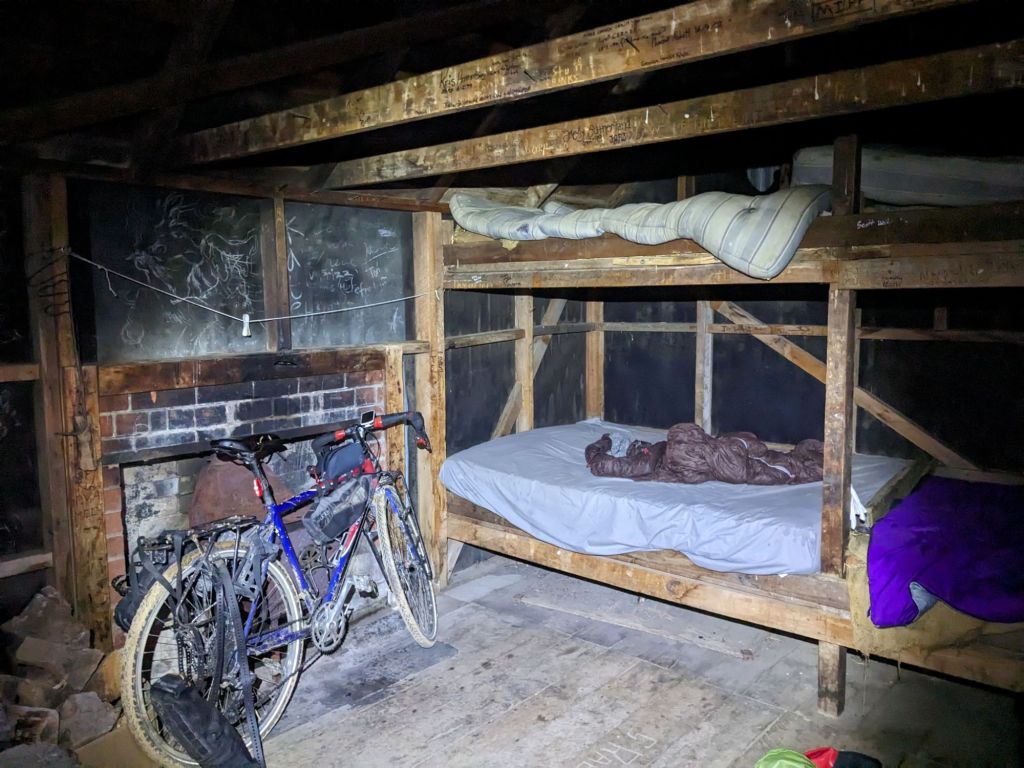
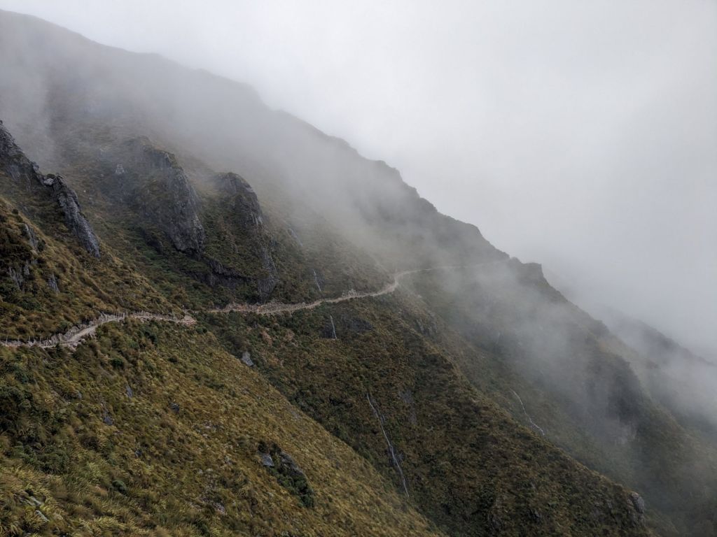
The first few days were spent crossing the Old Man Range and Old Woman’s Range. I’d hoped to do this back in October, but the track was covered in snow along what claims to be the highest road in the country. Climbing into the mountains, I was walking my bike most of the way. I definitely noticed my loss of fitness and I felt pretty run down after spending the last few days celebrating the end of an era in Te Anau, not having time to recover from the nine-day hike I’d just returned from. This was shown to be true when I was sleeping for twelve hours a night in each of the three huts I slept at. I was liking the solitude through the hills, seeing about one car or dirt bike a day.


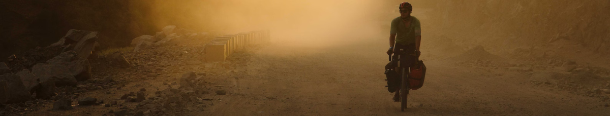
Rejoining the tarmac, I headed for Macetown. This was an old gold mining town which is now a campsite, reachable by a rough 4×4 track. The bike wasn’t enjoying the route, with about eight stream crossings before fifteen kilometres along a very dusty track. This combination of water and dust quickly turned to mud, wearing down the bike’s drivetrain. Arriving at the campsite and washing everything, I noticed the shimmer of the dust containing tiny specks of what I assumed to be gold. It was a cool place to explore with some old mining batteries left behind and a few huts to explore.


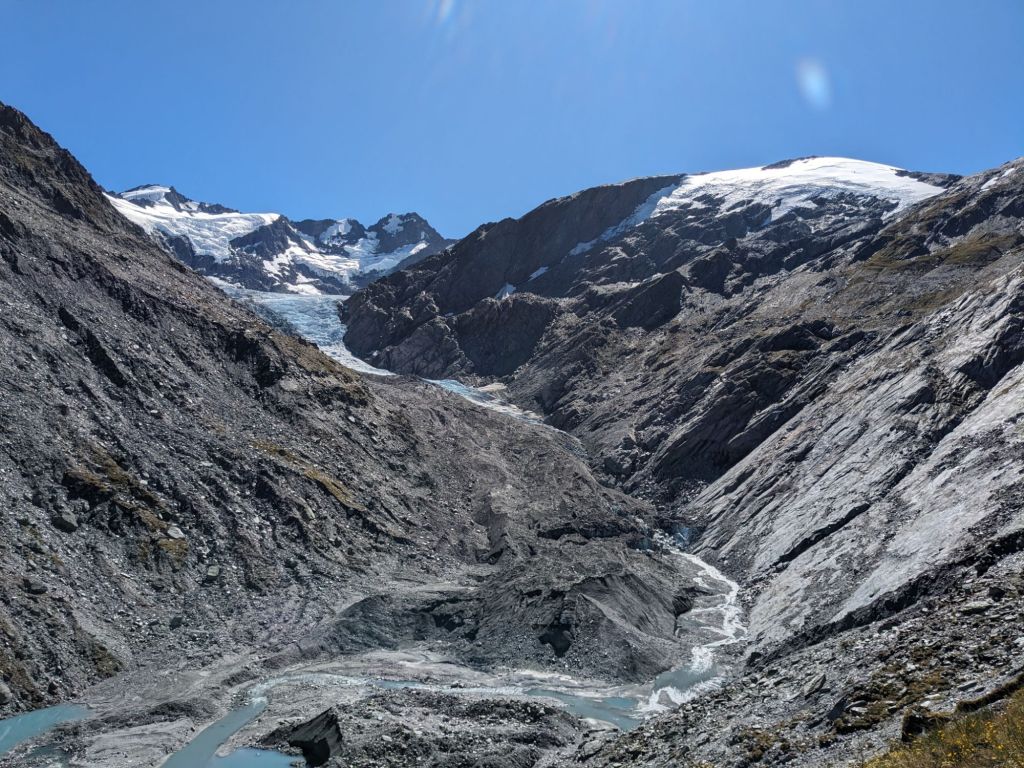
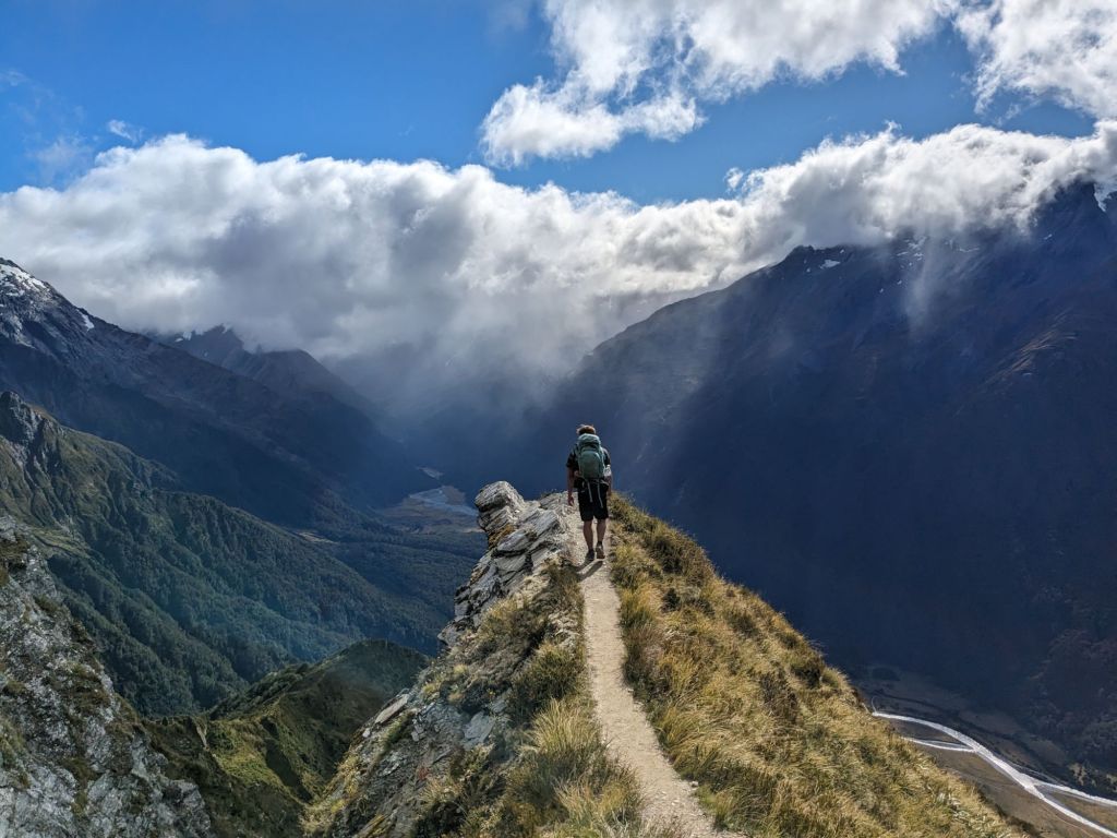
In Queenstown, I met up with my mate from the UK, Ryan, and headed off into the Mt Aspiring National Park for six days. I’d been tasked with giving him a tough hike, seeing the best NZ had to offer, and felt I delivered pretty well: hitchhiking a lift in the back of a pickup, staying in an alpine hut and seeing some incredible glacial valleys.


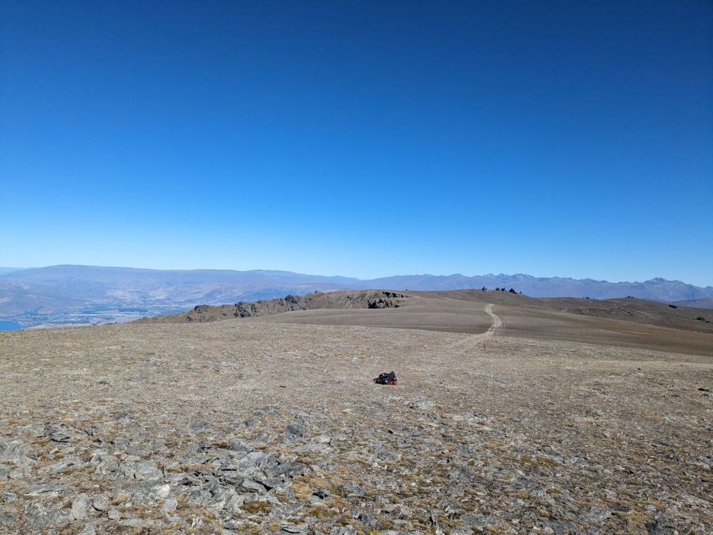
Returning to the riding, the bike was feeling very rough. I think the toll from the Macetown detour, combined with leaving it for a week, had seized up the bottom bracket. It started to improve whilst riding, but I could still tell something was wrong and I made my way to Wanaka over Crown Peak, another contender claiming the highest road in NZ. I didn’t see anyone else for the two days I was travelling through the Pisa Range and the views were impressive, looking down at the town of Cromwell.


At the bike shop in Wanaka, after a quick inspection, I was given the bad news. I was informed I’d need a new bottom bracket and new cranks, with the cranks costing $200 and probably taking three days for the part to arrive. However, the mechanic said he could probably bodge it with just the new bottom bracket, but it would probably only last another 1,000 km. I took this second option, wanting to get back on the road quickly, and he jokingly informed me as I was leaving that the warranty for the repair would expire the moment I left his shop.
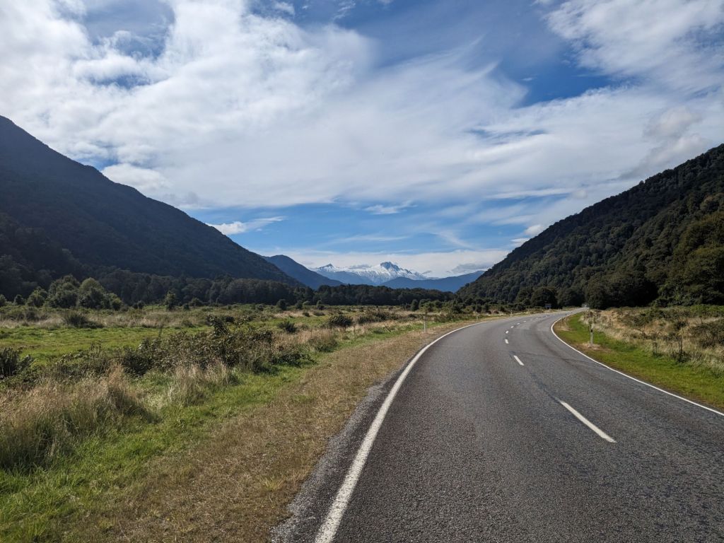
The bike did feel good again and the pedalling was far smoother than before. I was now heading up Highway 6, better known as the West Coast Highway.
Otago, the region I had spent the last few weeks travelling through, is the driest in New Zealand, but now I was heading into the wettest. The rain began almost immediately after I crossed over the Haast Pass and began descending towards the coast. It rained solidly for the next three days and, being on the remote highway, riding mostly through forest and farmland, there was little shelter from the elements.


Fortunately, there was a window of good weather and I took the opportunity to walk up the Copland Valley. The views were great walking up the huge river bed, before attempting to make it to the top of the pass. Unfortunately, this was all in thick cloud, so I turned back early, never seeing over the far side of what is one of the few routes that cross the Southern Alps. A small detour on the way back down the valley took me to the thermal hot pools. Honestly, I was a bit disappointed by them, as they just felt like lying in a muddy, tepid bath surrounded by strangers whilst the flys attacked any exposed skin above the water.


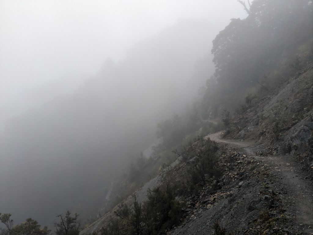
The three-day walk was a nice break from riding along the highway and, as I headed further north, I was joining up the cycle tracks of the West Coast Wilderness Trail, Paparoa Track and Old Ghost Road. These were more excuses to head through the mountains on some rough bike tracks. Unfortunately, the next storm hit just as I began the Old Ghost Road. This trail had been created through old mining country and was predominantly a walking track, but bikes were allowed. Fortunately, the first night I could shelter in a hut, but that just made continuing the following morning even harder, knowing I’d have to head back out into the rain. The second day on the track was really demoralising. It was mostly spent climbing up some very wet tracks and involved lots of pushing the bike, trying to enjoy the scenery through the rain. Having spent the entire day in the rain, it was a relief to get into the tent that night and try and dry off a bit. The rain persisted on the third morning and, heading down off the ridgeline, I managed to crash off the track, falling about two metres into some bushes below. Luckily I wasn’t hurt, but having seen no one all day, three guys turned the corner and saw me tangled up in the foliage. They didn’t laugh too much and helped me get my bags and bike back up onto the track. Checking the bike over, nothing seemed broken but it definitely wasn’t riding as nicely. I finished the track off, passing a few more groups coming the other way. They all seemed pretty miserable, like no one wanted to spend a weekend riding through the rain.


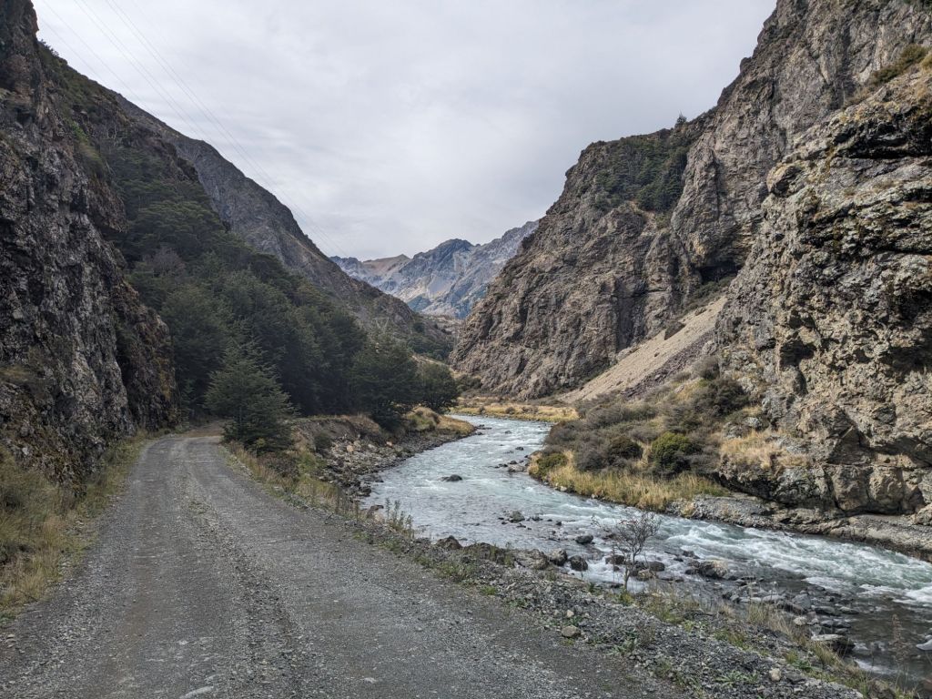
The rain cleared within minutes of leaving the track and I now headed east. From here I took Rainbow Road, a private toll road through Rainbow Station up the valley, then over the Alpine Island Saddle (which they also claim is the highest road in New Zealand), then looped back towards the north coast on the Molesworth Track that heads through the largest sheep station in the country. This area is known as the Marlborough High Country as the valleys are at around 900 m. This made it very cold when the next rain storm came through. Fortunately, I was next heading into the wine-growing region of Marlborough next, and the weather was set to be better.

I was really looking forward to the next section: the top of the South Island. I met up with Elise in Blenheim before hugging the coastline for a few days towards the Abel Tasman National Park.
At this point, my bike really started to play up. I’d realised my bike frame was bent where it met my rear derailleur, causing the gears to play up; the new bottom bracket was starting to play up; and both wheel hubs were very loose. It was at this point I’d accepted that I’d need a new bike in Australia and just needed this one to make it to the top of the country. So it was a welcome relief to leave the bike and hire a kayak to explore Abel Tasman. It was great to be back in a boat again and good fun paddling on the calm sea round the islands and up the lagoons. We spent three days paddling with picturesque beach camps each night.


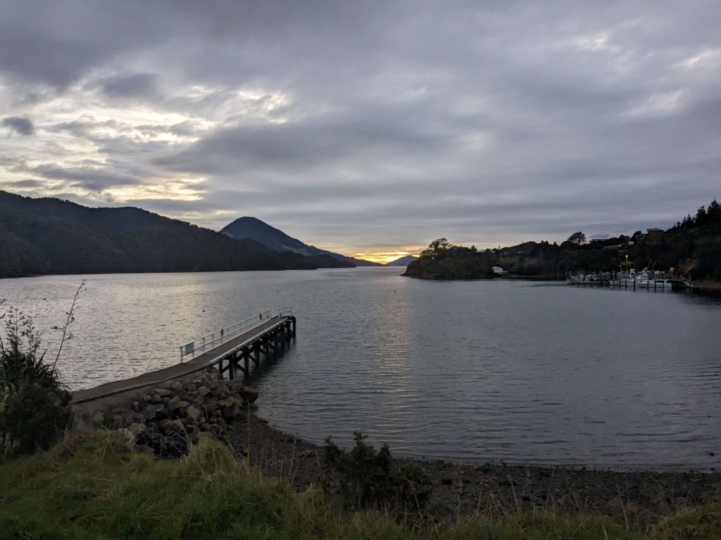

All that remained now of the South Island was a ride to the ferry terminal in Picton. I had loved the South Island and I really felt like I could call it home. Finding great camp spots each night had been easy and the riding was interesting with very little time spent just making up the miles between the exciting parts. Leaving for the North Island, I had that feeling of unknown anticipation I would get when entering a new country. I also hadn’t planned any of my journey from Wellington to Cape Reinga so, as the ferry departed, I got the map out and tried to figure out where I was going once the boat docked.
